Satellite data can offer a fresh perspective of life on Earth.
From ice cover to river colour and light pollution, it's a vital resource for researchers.
A World Economic Forum report has shown the value data can bring in areas as diverse as healthcare, industry and education.
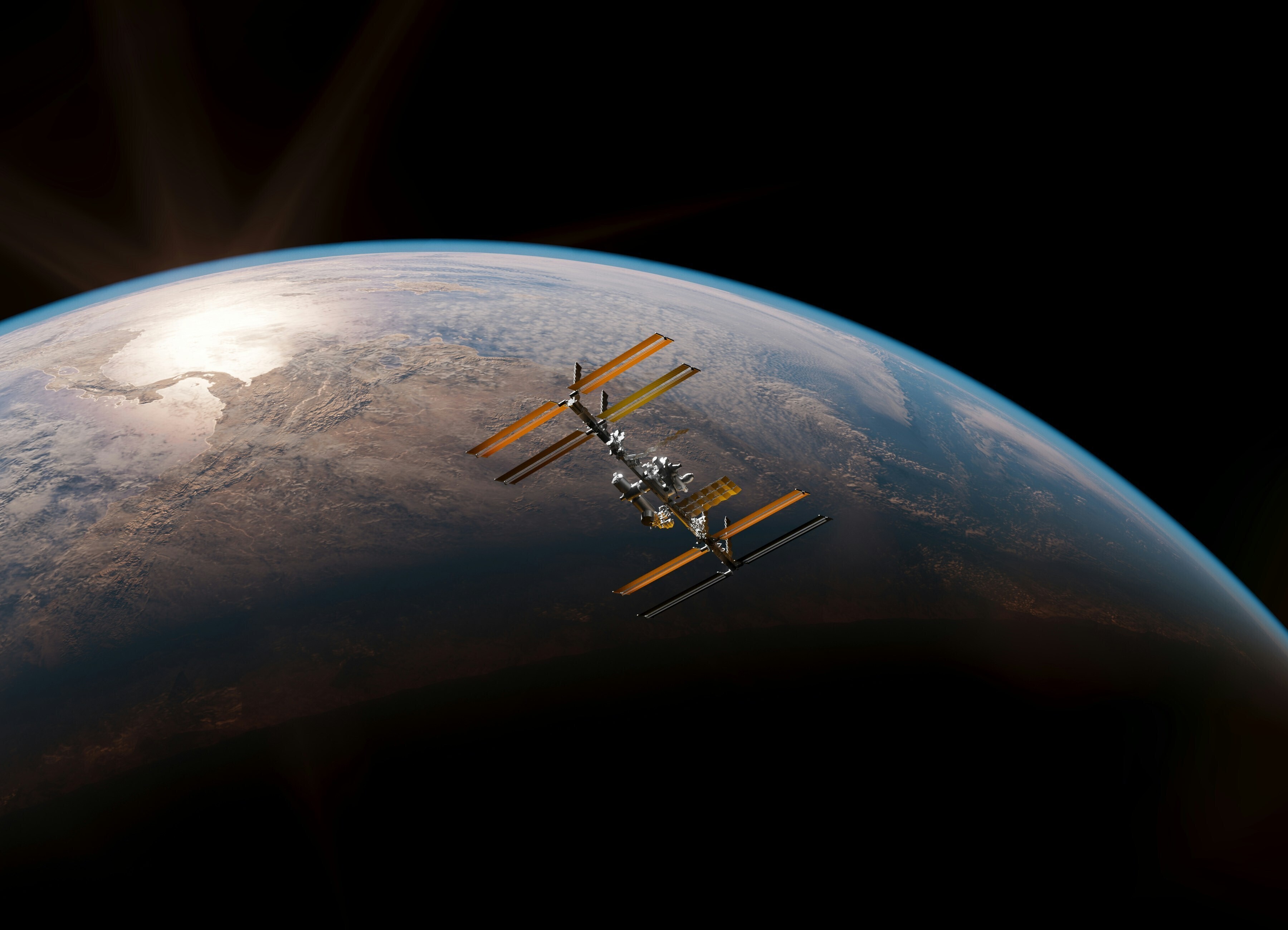
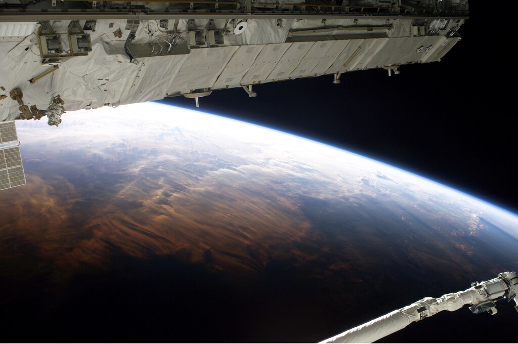
You're probably familiar with what the Earth looks like from space thanks to more than half a century of pictures sent back from above.
For example, chances are you know the iconic 'Earthrise' shot taken by Bill Anders aboard Apollo 8 - although maybe in its more familiar horizontal orientation.
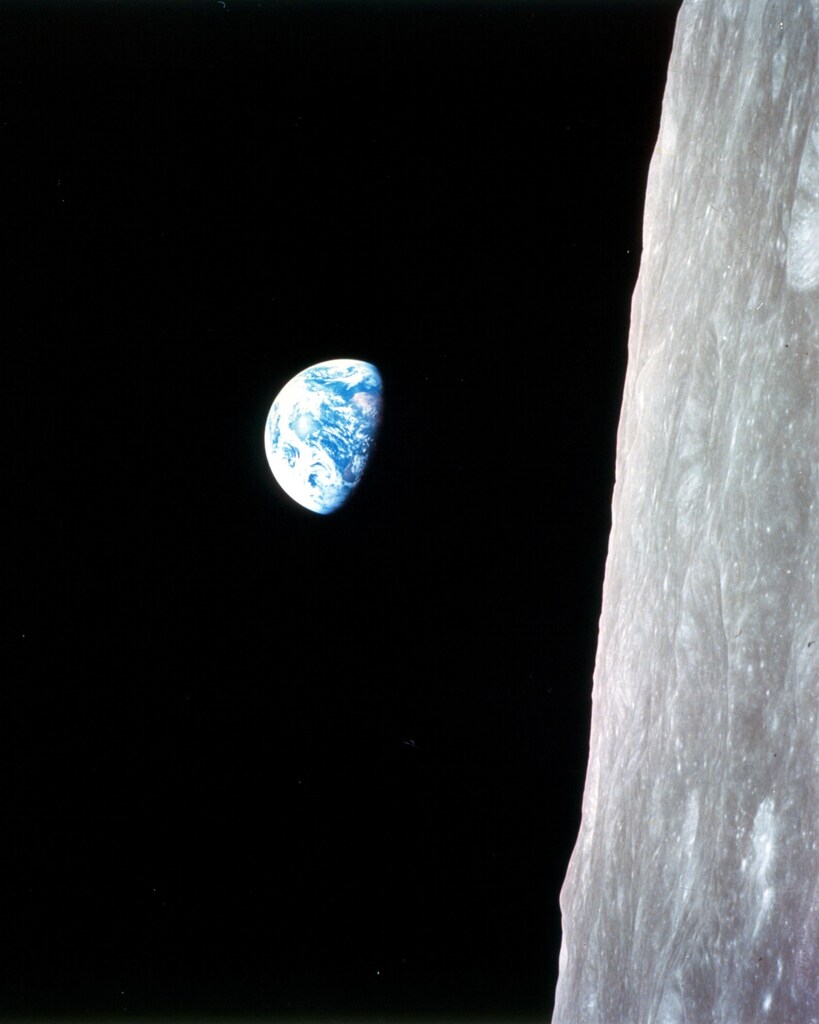
But, you might not know the sheer volume of photos taken from space and the work being done to build our understanding of life on Earth, from blue-green algae blooms to swings in Great Lakes ice cover.
1. What a difference a few days makes
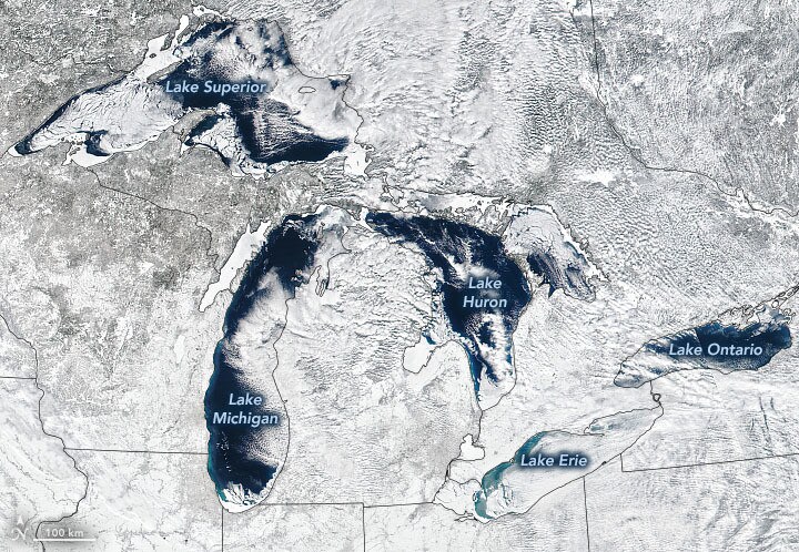
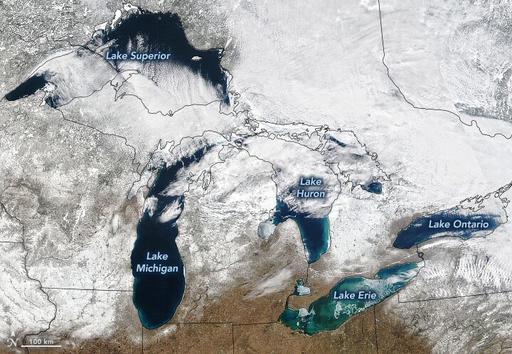
You can learn more about the changing ice cover, long-term averages and the climate patterns that control it here.
2. Where continents meet
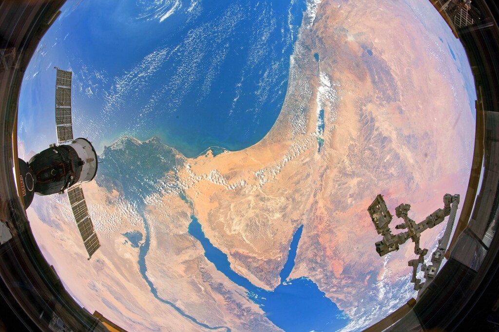
Astronaut Andrew Morgan took this shot from the International Space Station (ISS) in 2019, capturing the point at which two continents meet. Learn more about it here.
3. Up on high
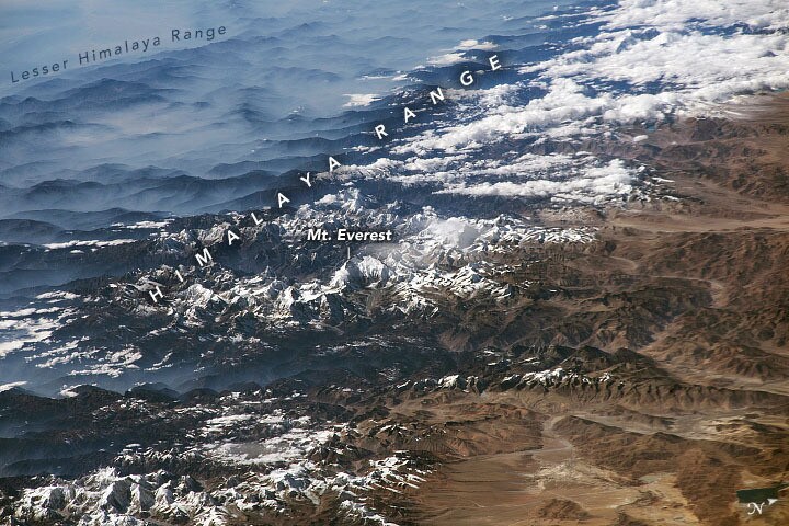
Another photo from aboard the ISS - this time taken by Randy Bresnik - it shows the Himalaya Range. Find out more about how it was taken here.
4. Shining a light
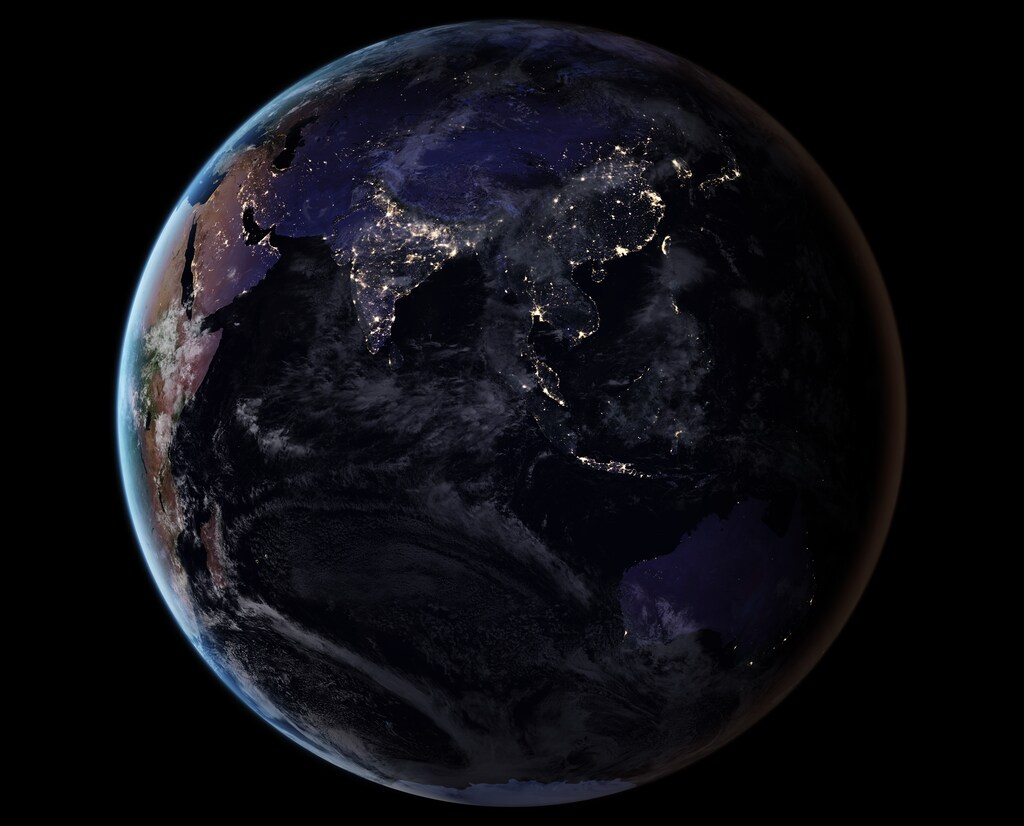
Night-time imagery can help monitor unregulated fishing, track sea ice movements and help reduce light pollution. Learn more about 'night lights' projects here.
5. Dust storms
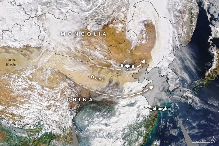
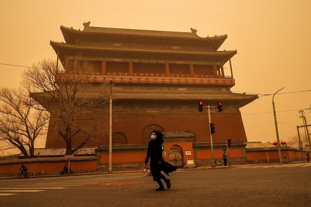
Satellite images can offer a fresh perspective of events on Earth, compared to 'on-the-ground' pictures. You can read more on the dust cloud's impact on air quality in Beijing here.
6. Blue-green algae blooms
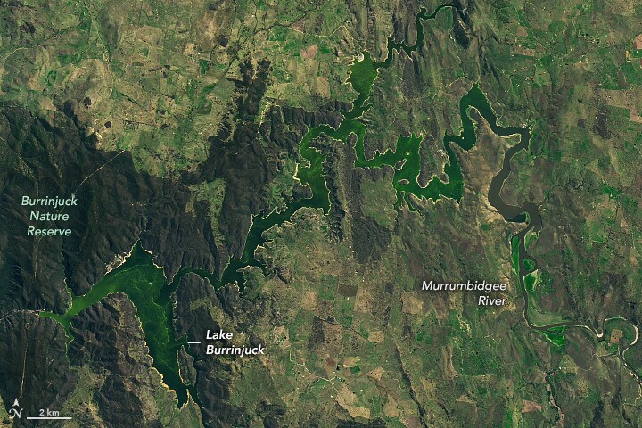
Authorities warned people to stay out the water as a result of the algae bloom, which can also harm fish populations. Read more about how fertilizer runoff can cause rapid reproduction of algae here.
7. Flooding in Mozambique
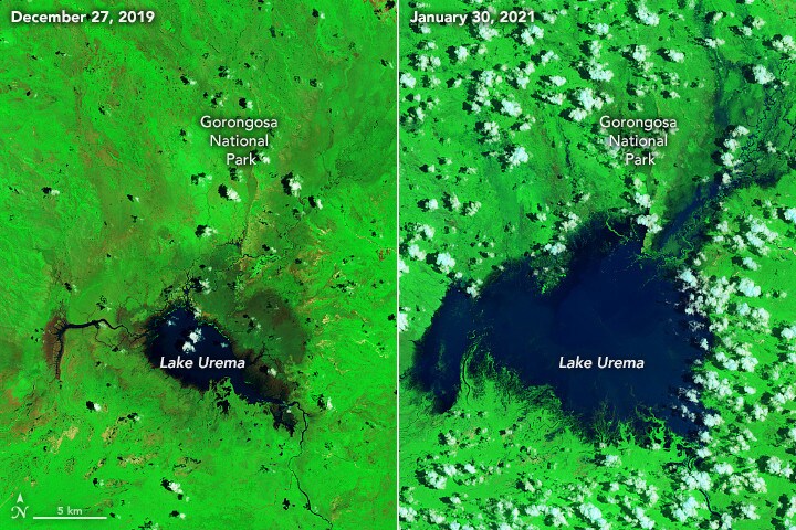
The images show flooding seven days after Tropical Cyclone Eloise struck Mozambique. Read more about the cyclone and its impact here.
8. Psychedelic phytoplankton
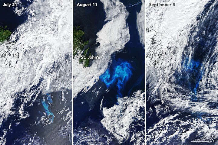
It's still not clear why the phytoplankton appeared in such numbers for so many weeks, but you can read more about the bloom here.
9. Changing river colours
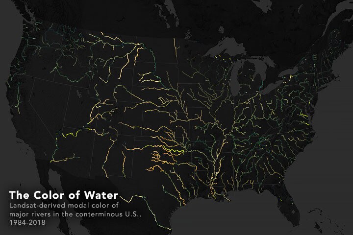
Recent research suggests that the dominant colour has changed in about one-third of large rivers in the continental United States over the last 35 years. Read more about the subtle changes that can drive this change here.
10. Missing snow
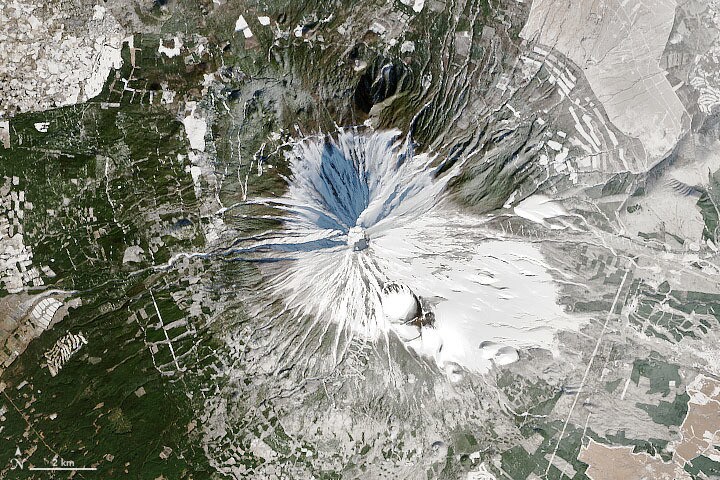
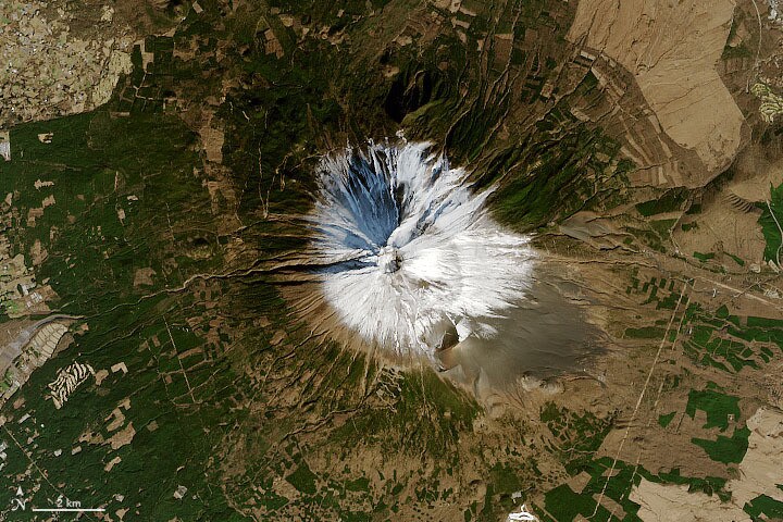
Snow cover on Mount Fuji in December 2020 was among the lowest in the 20 years NASA's Terra satellite has been monitoring it. Read more about it here.
What is the World Economic Forum doing about the Fourth Industrial Revolution?
The Centre for Frontier Technologies and Innovation brings together scientists, policymakers and business leaders to make sense of emerging technologies and their real-world implications.
By enabling collaboration and experimentation, the Centre helps partners translate innovation from research into practical applications that address shared global challenges.
A purpose beyond pictures
As these examples show, satellite imagery isn't just another perspective of life on Earth. Whether natural or with colours adjusted, it can offer lessons about some of the processes shaping the future of the planet.
And, as a World Economic Forum report from January 2021 shows, satellite images can support industrial growth, environmental protection, healthcare and education.
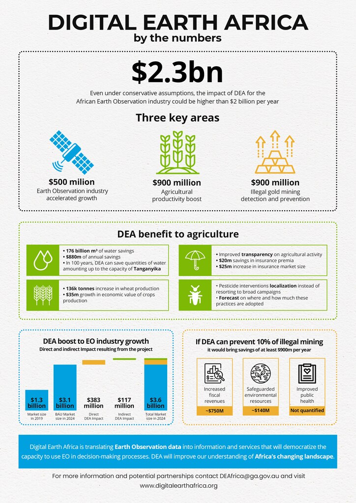
In Africa, this could unlock economic benefits worth billions.